A long weekend in Savannah

By now you may have caught on that I love big trees. Perhaps I was heavily influenced by hugging trees at Girl Scout camp when I was little? In any case, the trees in Savannah did not disappoint! They are tall with wide canopies, winding branches, and dripping with Spanish moss, and there are hundreds of them.

We did not walk through all 22 squares, but we saw a few on foot and a bunch more on the trolley ride. River Street was a fun place to stop for a drink and browse the outdoor market. And speaking of the Girl Scouts, we went on a tour of the Juliette Gordon Low Birthplace Museum, a must-see for any former scout!

Back to trees. Wormsloe State Historic Site is maybe 20 minutes from downtown, and totally worth the trip. There were some nice walking trails, but the drive into the park was the best. Just look at these live oaks!

Very Large Array

Very Large Array

About two hours south of Albuquerque, in the middle of nowhere, sits the Very Large Array. But it turns out that the middle of nowhere is perfect for an array of radio telescopes that spans 22 miles in its widest formation. There’s also little chance of interference from radio and tv broadcasts, wifi, and cell signals.

Very Large Array

We took a guided tour of the VLA, which allowed us to visit the control center and chat with a telescope operator. We also walked the path of the (very informative) self-guided tour. There are a few exhibits and several placards explaining the history and the science of the VLA.

Very Large Array

Very Large Array

We were lucky to visit when the VLA was in a hybrid formation. We got to see most of the telescopes clustered together, and watch them rotate in unison. And we also got to see a couple on the far end of one of the arms, which gave us a good sense of the immense scale of the VLA. (We saw these on the drive in/out, about 10 minutes from the main site!)

Very Large Array

Very Large Array

Does the VLA look familiar? Maybe you remember it from the movie Contact, with Jodie Foster! Scenes from Independence Day, The Arrival, and Terminator Salvation were also filmed here. Check out our movie of the VLA (a hyperlapse telescope rotation) on Instagram!

White Sands National Monument

White Sands National Monument

We liked White Sands so much we visited twice in two days! The first day we arrived around 4:00 and took the ranger’s advice to drive the loop during sunset and save hiking for another day. It was cloudy, windy, and cold—but it created a fun illusion that we were driving and walking around on ice.

White Sands National Monument

White Sands National Monument

There are several places to stop along the road and get out to walk on the dunes. One area has an elevated boardwalk and felt a bit more like a visit to the beach.

White Sands National Monument

You might not have a lot of time for exploring before the park closes, but White Sands is definitely worth a visit at the end of the day. The sunset creates some really neat colors and shadows on the dunes.

White Sands National Monument

We went back the next morning with a cloudless sky overhead. And, wow, those sands are bright! Blindingly white!

White Sands National Monument

White Sands National Monument

We passed a few people on the trail, but mostly it felt like we were alone. And it was so quiet out there!

One regret: not buying sleds at the visitor center. Yes, you can go sledding on the dunes! (FYI, frisbees do not work.)

Save

Save

Save

Palms to Pines Scenic Byway

This road is really fun. As the name suggests, you start out in the desert amid palm trees and wind your way through the San Bernardino National Forest, to discover small mountain villages surrounded by pine trees.

Palms to Pines Scenic Byway

We started in Palm Desert and stopped in Idyllwild before completing the loop back to the valley. The first part of this drive switchbacks up the desert hills. The road is often narrow and it feels like you’re in a little rock canyon.

Palms to Pines Scenic Byway

We passed dozens of beautiful Porsche 356’s driving the opposite way. Where were they all coming from?!

Porsche 356

There are some scenic vista pull-outs along the drive, some with short nature trails. It’s amazing how high you climb in a short time. Can you see that looping road we drove up?

Palms to Pines Scenic Byway

Palms to Pines Scenic Byway

And then, ta-da! You’re in the forest! Idyllwild is a cute little village with a handful of shops and restaurants. We learned at the history center — a small log cabin — that the area is popular for rock climbing. The docent also told us that Ashton Kutcher and Mila Kunis were there a couple of weeks ago, among other tidbits about pioneer life and Elvis Presley movies.

Palms to Pines Scenic Byway

Palms to Pines Scenic Byway

On the drive back, we caught this amazing sunset! (We also got stuck in a traffic jam so bad that people turned off their cars and walked around to find out what was happening. But a nice view of the city lights below and a bag of kettle corn made the time pass quickly.)

Palms to Pines Scenic Byway

Save

Joshua Tree National Park

Welcome to Cool Trees and Rocks: Desert Edition! Our day at Joshua Tree National Park was spent on the Mojave Desert side of the park. We entered the park at the Oasis Visitor Center, drove down to the Cholla Cactus Garden, then back up to Keys View and Hidden Valley.

Cholla Cactus Garden, Joshua Tree National Park

In addition to long day hikes and backpacking trails, Joshua Tree has several nature trails. These were easy walks and were a nice way to experience different areas of the park. The picnic areas and campground pull-offs were also great spots to stop and view scenery (and watch rock climbers).

Joshua Tree National Park

Joshua Tree National Park

Joshua Tree National Park

Joshua Tree National Park

Have you guys been watching Westworld? This way to the maze!

Of course we saw the famous Joshua trees, too…

Joshua Tree National Park

Joshua Tree National Park

At an elevation of 5,185 feet, Keys View is a great spot to look out over Coachella Valley — including the San Andreas Fault, which was right below us!

Joshua Tree National Park

Joshua Tree National Park

Save

Save

Save

Save

Save

Save

Highway 1 and Big Sur

Also known as the Pacific Coast Highway, Highway 1 winds down the California coast from Monterey/Carmel to San Simeon. We drove about halfway down to see the Big Sur area.

Highway 1 Big Sur

It’s a fun road, with steep hills on one side, and cliffs falling to the ocean on the other.

Highway 1, Big Sur, California

Highway 1, Big Sur, California

There are plenty of pull-outs along the road to take in the views. Bixby Bridge is a popular stop.

Bixby Bridge, Big Sur

At Julia Pfeiffer Burns State Park, there’s a short walk from the parking area to a pretty amazing 80ft tidefall, McWay Falls. (What’s a tidefall? It’s a waterfall that ends at the sea!)

Wait for it…

McWay Falls, Big Sur California

…ta-da!!!

McWay Falls, Big Sur California

Even though the beach is off limits, a few surfers swam up through the cove while we were there.

Surfers at McWay Falls, Big Sur

Surfers at McWay Falls, Big Sur

Our last stop of the day was Garrapata State Park. Just off Highway 1 is a beautiful trail that hugs the coastline. It was a bit windy, but a great place to catch the (very cloudy) sunset.

Garrapata State Park, Big Sur

Save

Save

Save

Save

Save

17-Mile Drive

17-Mile Drive is just what it sounds like: a scenic drive that’s 17 miles long. And, wow, what a beautiful ride!

17 Mile Drive

17 Mile Drive

There are 21 “points of interest” marked along the route. Several of them are on the coast where you can walk along the rocky shore. I know it sounds funny to get excited about water and rocks, but when the big waves come in and crash loudly against the rocks, it’s very dramatic!

17 Mile Drive

17 Mile Drive

This little island was full of sea lions. And we saw a few sea birds, too, Amanda!

17 Mile Drive

17 Mile Drive

The drive also takes you through a nature preserve full of pine and cypress trees. The symbol of Pebble Beach, the famous Lone Cypress tree, is more than 250 years old!

17 Mile Drive

17 Mile Drive

There are a few golf courses along the route as well. The Lodge at Pebble Beach has a pretty spectacular view of the 18th hole, right on the water. Maybe I should start taking lessons!

Pebble Beach


Beaches and trees

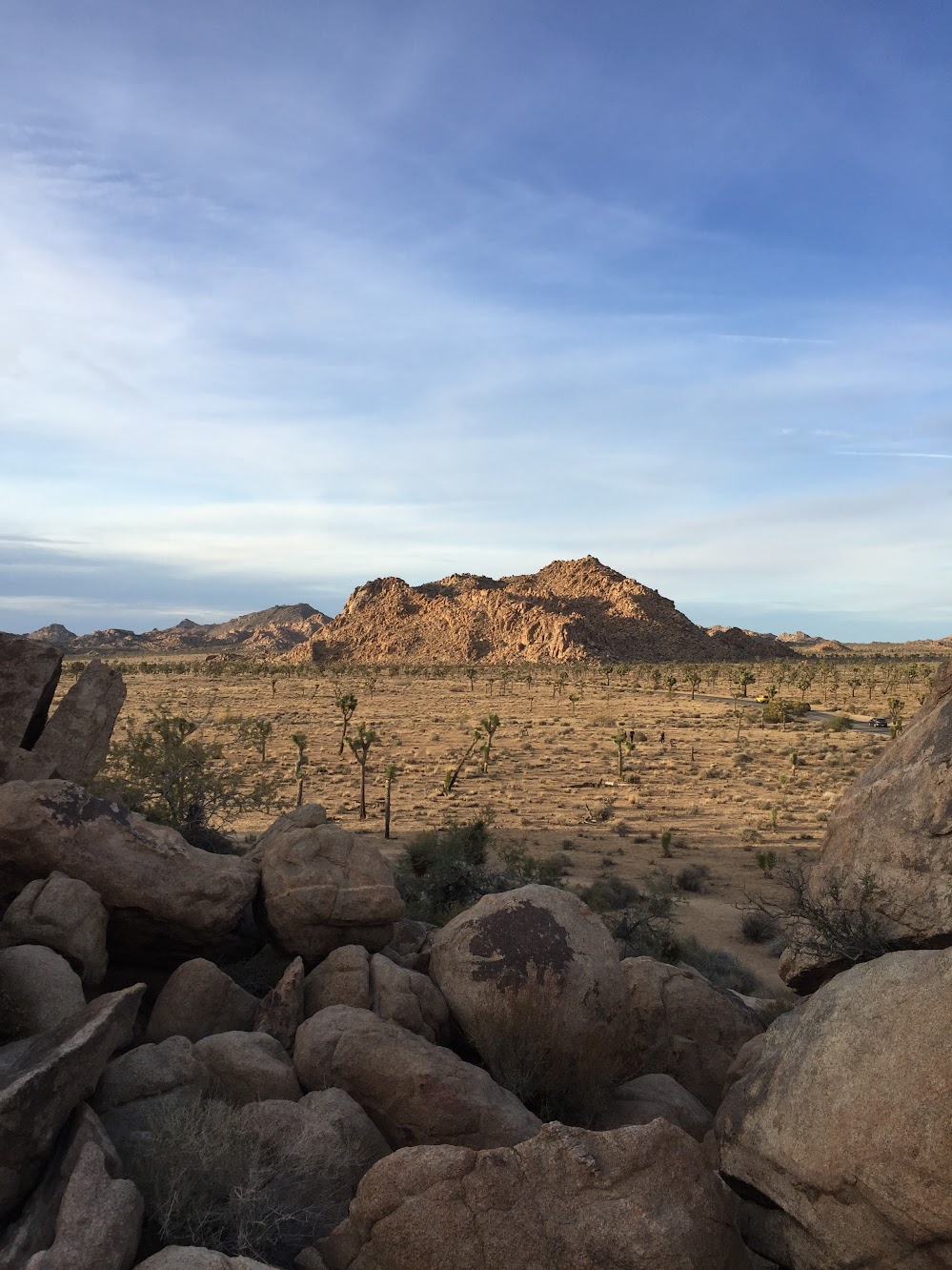
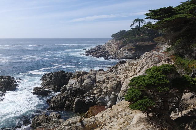
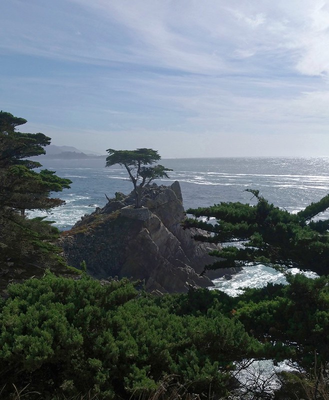
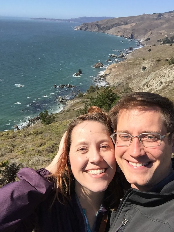
Were we in Mount Tamalpais State Park or the Golden Gate National Recreation Area? I have no idea! But we found an excellent route for an afternoon of scenic driving and pretty walks along the Pacific.

From 101, we took the curvy Shoreline Highway (Rt 1) towards the coast. First stop: picnic at Muir Beach Overlook.

Muir Beach Overlook

Muir Beach Overlook

Muir Beach Overlook

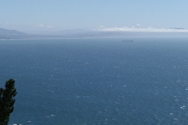
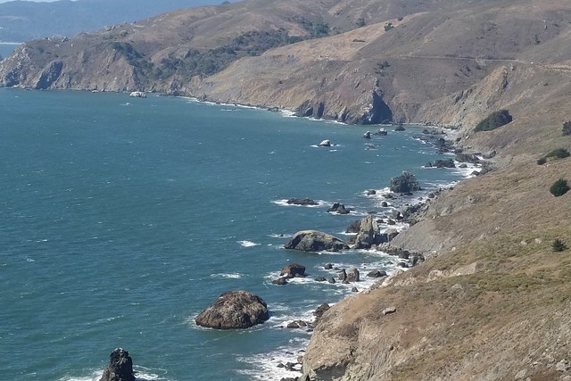
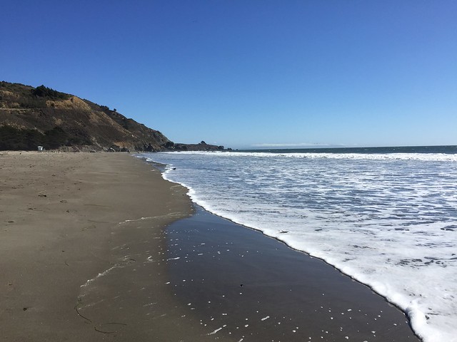
We then continued on Shoreline Highway up to Stinson Beach. This part of the road hugs the coastline and there are some overlooks for checking out the view below. Stinson Beach was really long compared to other beaches around here, so we took a nice walk along the chilly sand. It was a breezy 70 degrees! FYI, the Parkside Snack Bar has excellent soft serve.

Stinson Beach

Stinson Beach

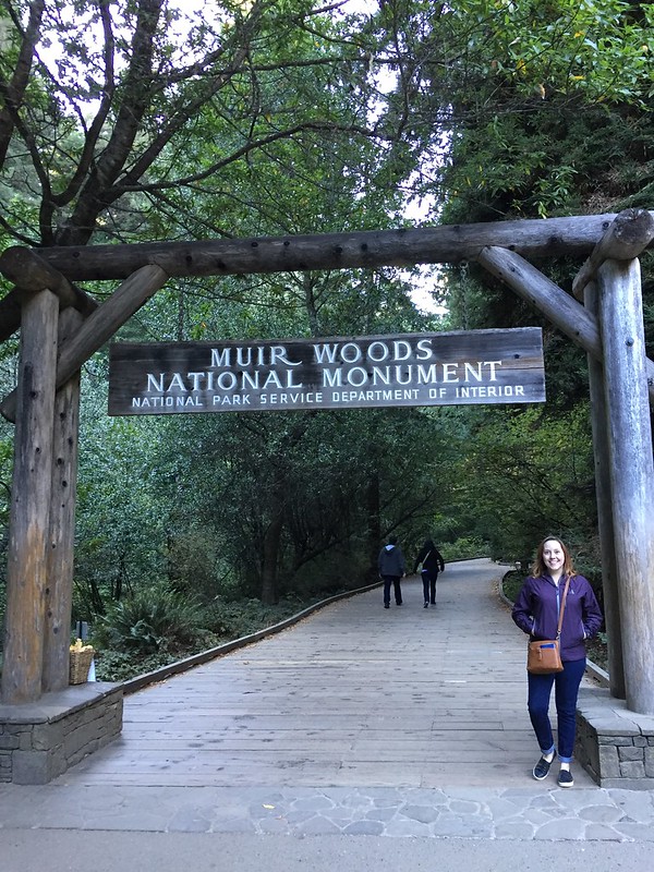
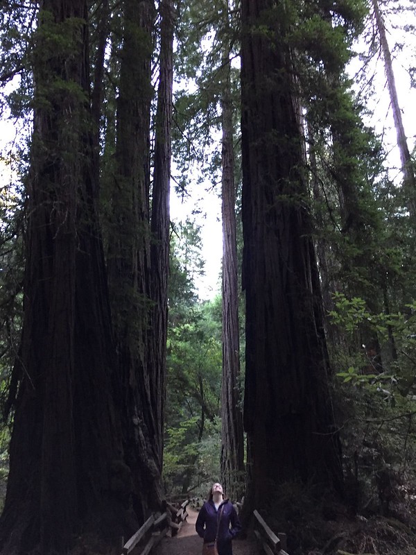
Next up, the Panoramic Highway, another twisty turny road. This road and the Shoreline Highway felt like car commercial roads. In fact, we saw a small film crew! They were filming a vintage station wagon driving around. Maybe we will be in the background! Anyways, the Panoramic Highway took us to Muir Woods National Monument. We visited the woods several years ago and were both happy to visit again. Plus, I got stamps for my National Parks Passport!

Muir Woods National Monument

Muir Woods National Monument

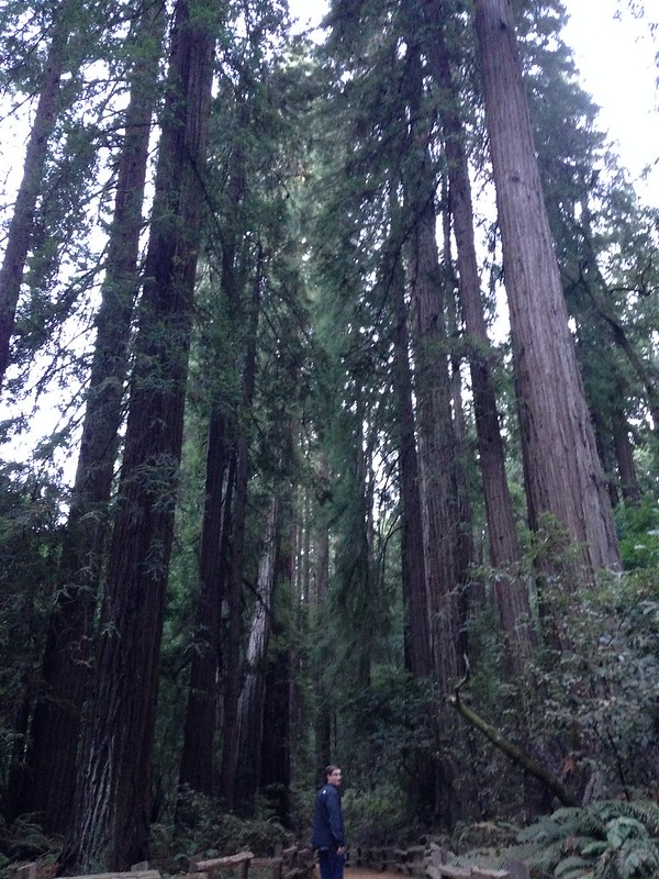
It’s hard to capture in a photo, but these trees are giants! I know we’re just talking about trees, but they really are amazing. Dare I say, majestic!

Muir Woods

Muir Woods National Monument

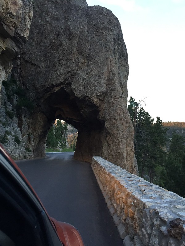
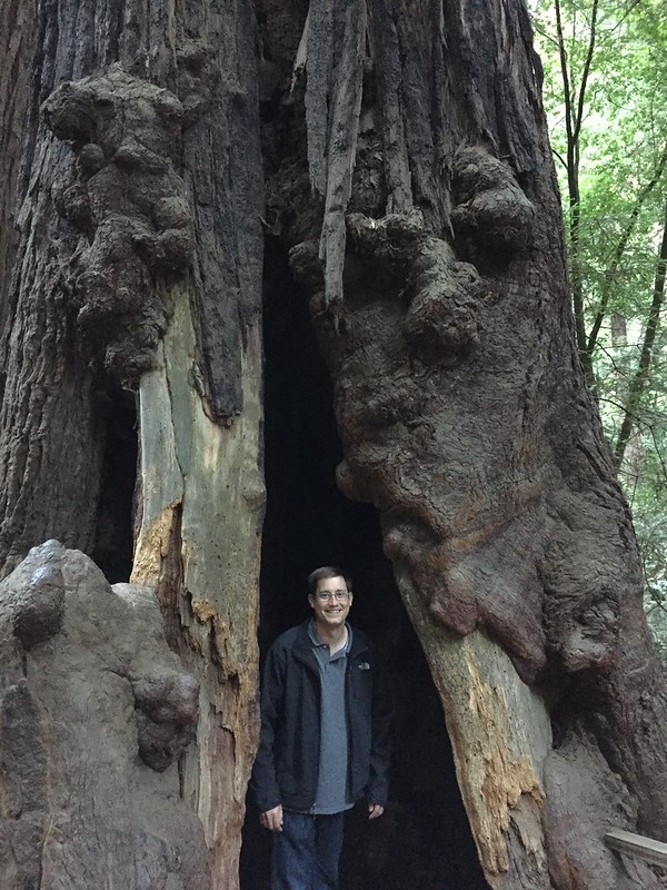
Kenan found the entrance to the Upside Down!

Muir Woods National Monument

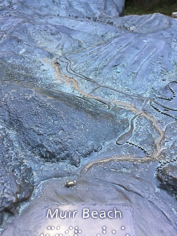
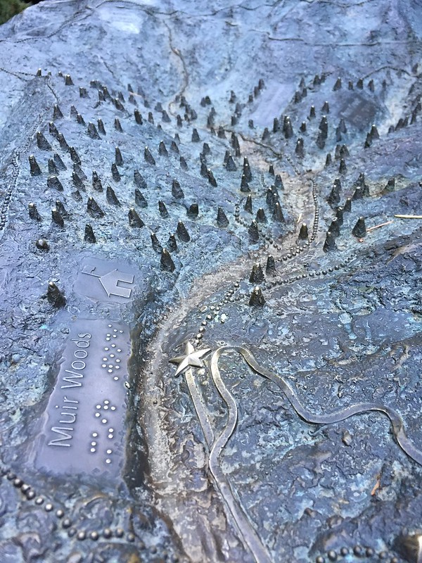
At some of the parks in this area we found these neat models of the landscape. Doesn’t it remind you of the Game of Thrones opening credits?

Muir Beach

Muir Woods

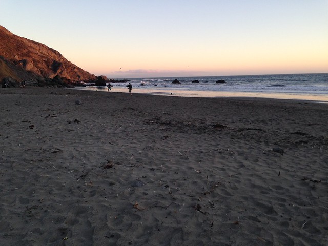
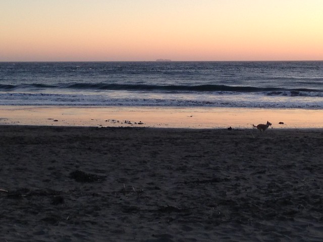
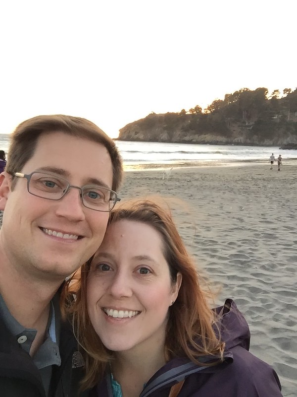
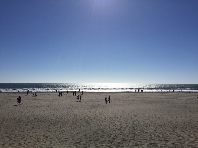
Muir Woods Road took us back down to the coast for sunset at Muir Beach. This place gave me a “whoa, we are definitely in California” vibe. There were people playing frisbee, dogs running wild, a bunch of groups huddled around bonfires…and a guy playing bongo drums!

Muir Beach

Muir Beach

Muir Beach

Road trip to California

The drive from Salt Lake City to Marin County, California is long but easy. Take I-80 west and just keep going! There’s some fun things along the route to break up the trip, like…

The Bonneville salt flats! Salt as far as the eye can see! The salt is crunchy underfoot and is quite bright to look at.

Bonneville Salt Flats

Bonneville Salt Flats

This humongous log!

Gateway to the Pacific Northwest

Gateway to the Pacific Northwest

Reno — I donated $1 to the slot machines!

Reno

Lake Tahoe! I’d love to go back here for vacation. From the highway, you have to drive up a twisty mountain road, but then you’re rewarded with a beautiful view of the lake and surrounding wooded hills. If you drive around the north side of the lake, you can head back to 80 near Tahoe City.

Mount Rose, Lake Tahoe

Lake Tahoe

Lake Tahoe

Lake Tahoe

Lake Tahoe

And last, but not least, Donner Memorial State Park! Yup, the cannibals. The visitor center has a really interesting exhibit about the family’s journey and the history of the Transcontinental Railroad.

Donner Memorial State Park

Hooray, we made it the west coast! (On September 12 if you’re keeping track.)

Save

Save

Custer State Park

We traveled to Custer State Park along the Iron Mountain Road. This road is bonkers! There are wooden pigtail bridges, where you curly-cue your way up the mountain, several switchbacks, and a few one lane tunnels, which are carved out of the stone to perfectly frame a distant view of Mount Rushmore.

In Custer State Park, we took the Wildlife Loop Road — a 25mph trip along an 18-mile road through vast grasslands. For miles, the only wildlife we saw was one deer, but finally we found the bison herd. TATANKA! (Kevin Costner narrates the film at the new visitor’s center.) They were grazing in the distance, but we had a good view with the binoculars. Further down the loop, we also saw the infamous burros and a bunch of prairie dogs.

Bison at Custer State Park

Binocular view of bison at Custer State Park

Burros at Custer State Park

Coming out of the Wildlife Loop, we drove up Needles Highway (thanks for the tip, mom and dad!) to Sylvan Lake. That’s another crazy road! Up close views of towering rocks that seem to pop up out of nowhere, and nice overlooks to see the forest.

Needles Highway, Custer State Park

Scenic overlook on Needles Highway, Custer State Park

Needles Highway, Custer State Park

Needles Highway, Custer State Park

Sunset at Sylvan Lake, Custer State Park


Save